Modern warfare is no longer decided by the performance of a single aircraft, missile, or satellite.
It is increasingly determined by the ability to integrate multiple intelligence disciplines into a single continuous operational picture.
The decisive military advantage now lies in compressing the time between detecting, identifying, validating and precisely striking a target.
This evolution has transformed space-based reconnaissance from a supporting capability into the backbone of modern military operations.
Satellites no longer operate as isolated collection platforms. They function as interconnected nodes within a fused intelligence architecture that combines imagery, radar, electronic intelligence, geospatial mapping, and maritime surveillance into a single decision-making system.
Understanding that architecture also helps explain one of the defining features of the recent US-Iran war.
Despite months of sustained American and Israeli air strikes, Iran continued to launch increasingly accurate retaliatory attacks against American military facilities, regional support infrastructure, and strategic energy assets across the Middle East.
That level of precision was not achieved by missiles alone. It was enabled by intelligence.
The contribution of Russia
The contribution of Russia to that intelligence picture has often been misunderstood.
Public discussion has tended to focus on individual satellites or on dramatic claims about specific spacecraft supporting Iranian operations. The reality is both more sophisticated and considerably more important.
Russia’s military advantage lies not in a single satellite, but in an integrated military geospatial reconnaissance architecture.
Each satellite family performs a distinct function while contributing to a common operational picture
The Russian military space enterprise should be understood as a layered intelligence system rather than a collection of separate constellations.
Each satellite family performs a distinct function while contributing to a common operational picture.
The resulting intelligence product is created through fusion rather than through any individual platform.
Collection of high-resolution imagery
At the centre of this architecture sits the Persona family of electro-optical reconnaissance satellites (Geospatial Intelligence or GEOINT).
Their primary role is to collect high-resolution imagery for strategic targets, military infrastructure, air bases, ports, missile sites, and battle damage assessment.
Optical imagery provides the visual foundation on which the wider intelligence picture is built.
SAR satellites can image through darkness, cloud cover, smoke, and adverse weather
Complementing Persona is the Kondor-FKA Synthetic Aperture Radar (GEOINT-SAR) constellation.
Unlike optical systems, SAR satellites can image through darkness, cloud cover, smoke, and adverse weather. They provide persistent surveillance, change detection, and all-weather monitoring, allowing military planners to maintain continuity when electro-optical collection is unavailable.
Neither system operates independently.
How the targets behave electronically
Electronic intelligence (ELINT, a subset of Signals Intelligence SIGINT) is supplied primarily by the Lotos-S1 constellation.
These satellites collect radar emissions, characterise electronic signatures, intercept communications, and build an electronic order of battle.
Rather than showing what a military installation looks like, they reveal how it behaves electronically.
That distinction is crucial during wartime, as emissions often expose operational readiness long before aircraft begin moving.
The Pion-NKS (SIGINT) constellation focuses on naval reconnaissance and maritime electronic intelligence
Military geodesy represents another essential layer. Russia’s Bars-M (GEOINT) satellites refine precision coordinates, generate digital terrain products, and provide highly accurate geospatial reference data.
Precision-guided weapons are only as accurate as the coordinates supporting them. High-quality geodetic refinement therefore becomes indispensable for modern strike planning.
Maritime operations add an additional dimension. The Pion-NKS (SIGINT) constellation focuses on naval reconnaissance and maritime electronic intelligence.
Surface vessel tracking, naval emissions, and broader maritime situational awareness become increasingly important during conflicts centred on critical waterways such as the Strait of Hormuz.
Comprehensive military intelligence architecture
Viewed individually, each of these constellations performs a specialised function. Viewed collectively, they form a comprehensive military intelligence architecture capable of supporting complex regional operations.
This distinction explains why public reporting often oversimplifies Russian support to Iran.
Analysts frequently attempt to attribute individual collection events to a specific satellite carrying a particular Kosmos designation. In reality, publicly available information rarely permits that degree of certainty.
The more rigorous analytical approach is to attribute collection to satellite families rather than to individual spacecraft.
The finished intelligence product is the result of multiple complementary sensing disciplines operating together
Publicly available orbital information often allows analysts to determine that a Persona-class satellite or a Lotos-S1 platform was capable of collecting against a given objective.
It rarely allows definitive identification of the exact spacecraft responsible for a specific collection event.
That distinction matters because modern military intelligence is inherently multi-sensor.
An American air base in Jordan, for example, is unlikely to be monitored by a single satellite.
Optical imagery may originate from a Persona platform. Radar coverage may come from Kondor-FKA during poor weather. Electronic emissions may be collected by Lotos-S1. Coordinate refinement may rely on Bars-M. Maritime context may be supplied by Pion-NKS where appropriate.
The finished intelligence product is therefore the result of multiple complementary sensing disciplines operating together.
Increasing precision
This fused approach also explains the increasing precision observed during Iranian retaliatory operations throughout the conflict.
Iranian missile strikes repeatedly demonstrated awareness of American operating locations, regional command infrastructure, aircraft support facilities, and strategic energy installations across several Middle Eastern states. Such targeting requires far more than satellite imagery.
It requires persistent surveillance, electronic mapping, precision geodesy, radar collection, battle-damage assessment, and continuous intelligence updating.
Russia’s integrated reconnaissance architecture provides precisely those enabling functions.
This should not be interpreted as suggesting that Russian satellites directly controlled Iranian military operations. They did not.
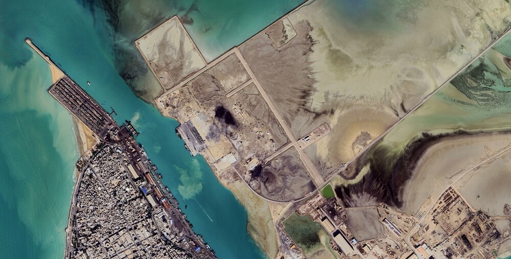 Russian military space capabilities provided a powerful intelligence force multiplier that substantially improved Iran’s situational awareness across the regional battlespace
Operational decisions remained Iranian. What Russian military space capabilities provided was a powerful intelligence force multiplier that substantially improved Iran’s situational awareness across the regional battlespace.
That distinction is both technically accurate and strategically important.
Modern precision warfare increasingly depends on who possesses the most complete understanding of the battlespace rather than simply on who fields the most advanced aircraft.
Superior intelligence shortens sensor-to-shooter timelines, improves targeting accuracy, reduces uncertainty, and allows commanders to make decisions based on a continuously updated operational picture.
Throughout the recent conflict, Iran demonstrated a level of targeting precision that surprised many outside observers.
The explanation does not lie solely in improvements to Iranian missile technology. It also lies in the quality of the intelligence architecture supporting those strikes.
Russia’s integrated military geospatial reconnaissance enterprise has quietly become one of the world’s most capable space-based intelligence systems.
Its real strength lies not in any single satellite but in the fusion of electro-optical imagery, synthetic aperture radar, electronic intelligence, communications intelligence, military geodesy, and maritime reconnaissance into a coherent operational architecture.
That architecture has emerged as one of the least visible – but arguably most consequential – force multipliers in the modern Middle Eastern battlespace.
Dr Nawaf Obaid is a Senior Research Fellow at the Department of War Studies, King’s College London.